
Harlech topographic map
Interactive map
Click on the map to display elevation.
About this map
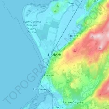
Name: Harlech topographic map, elevation, terrain.
Location: Harlech, Gwynedd, Wales, LL46 2SG, Vereinigtes Königreich (52.81877 -4.14745 52.89877 -4.06745)
Average elevation: 223 ft
Minimum elevation: -3 ft
Maximum elevation: 1,257 ft