
Plateau d'Hauteville topographic map
Interactive map
Click on the map to display elevation.
About this map
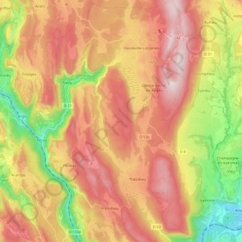
Name: Plateau d'Hauteville topographic map, elevation, terrain.
Average elevation: 2,513 ft
Minimum elevation: 801 ft
Maximum elevation: 4,029 ft