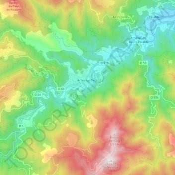
Arles-sur-Tech topographic map
Interactive map
Click on the map to display elevation.
About this map
Name: Arles-sur-Tech topographic map, elevation, terrain.
Average elevation: 2,018 ft
Minimum elevation: 607 ft
Maximum elevation: 4,245 ft

Click on the map to display elevation.
Name: Arles-sur-Tech topographic map, elevation, terrain.
Average elevation: 2,018 ft
Minimum elevation: 607 ft
Maximum elevation: 4,245 ft