
Ridgetop topographic map
Interactive map
Click on the map to display elevation.
About this map
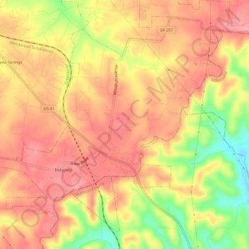
Name: Ridgetop topographic map, elevation, terrain.
Average elevation: 801 ft
Minimum elevation: 568 ft
Maximum elevation: 922 ft
Other topographic maps
Click on a map to view its topography, its elevation and its terrain.
Greenbrier
United States > Tennessee > Robertson County
Greenbrier, Robertson County, Tennessee, 37073, United States
Average elevation: 801 ft
Springfield
United States > Tennessee > Robertson County
Springfield, Robertson County, Middle Tennessee, Tennessee, 37172, United States
Average elevation: 666 ft