
Gross Spannort topographic map
Interactive map
Click on the map to display elevation.
About this map
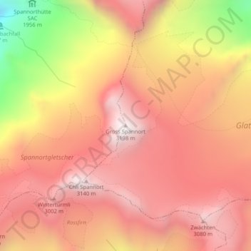
Name: Gross Spannort topographic map, elevation, terrain.
Location: Gross Spannort, Attinghausen, Uri, 6468, Svizzera (46.78662 8.52439 46.78672 8.52449)
Average elevation: 8,704 ft
Minimum elevation: 5,456 ft
Maximum elevation: 10,367 ft