
Longgang District topographic map
Interactive map
Click on the map to display elevation.
About this map
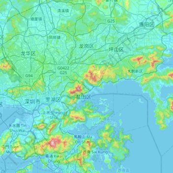
Name: Longgang District topographic map, elevation, terrain.
Location: Longgang District, Shenzhen City, Guangdong, 518100, PRC (22.36514 114.04661 22.81644 114.64619)
Average elevation: 246 ft
Minimum elevation: -20 ft
Maximum elevation: 3,022 ft