
Srebrenica topographic map
Interactive map
Click on the map to display elevation.
About this map
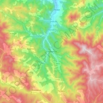
Name: Srebrenica topographic map, elevation, terrain.
Location: Srebrenica, Srebrenica municipality, Republika Srpska, B&H (44.06632 19.25528 44.14632 19.33528)
Average elevation: 2,018 ft
Minimum elevation: 804 ft
Maximum elevation: 3,297 ft