
Volcán Llaima topographic map
Interactive map
Click on the map to display elevation.
About this map
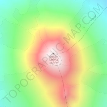
Name: Volcán Llaima topographic map, elevation, terrain.
Average elevation: 8,264 ft
Minimum elevation: 6,844 ft
Maximum elevation: 10,125 ft
The average elevation of the terrain around Llaima is about 740 m asl.
Other topographic maps
Click on a map to view its topography, its elevation and its terrain.
Llaima
Chile > Araucanía Region > Provincia de Cautín > Vilcún
Llaima, Vilcún, Provincia de Cautín, Araucanía Region, Chile
Average elevation: 1,093 ft