
Valle de los Fantasmas topographic map
Interactive map
Click on the map to display elevation.
About this map
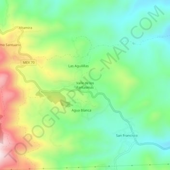
Name: Valle de los Fantasmas topographic map, elevation, terrain.
Location: Valle de los Fantasmas, Zaragoza, San Luis Potosí, México (22.04618 -100.63909 22.08618 -100.59909)
Average elevation: 7,635 ft
Minimum elevation: 6,998 ft
Maximum elevation: 8,799 ft