
Huston topographic map
Interactive map
Click on the map to display elevation.
About this map
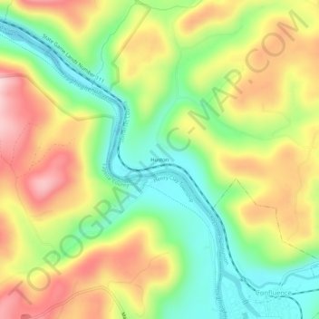
Name: Huston topographic map, elevation, terrain.
Location: Huston, Somerset County, Pennsylvania, 15424, United States (39.80952 -79.39531 39.84952 -79.35531)
Average elevation: 1,690 ft
Minimum elevation: 1,257 ft
Maximum elevation: 2,205 ft