
Bubiyan Island topographic map
Interactive map
Click on the map to display elevation.
About this map
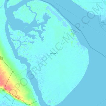
Name: Bubiyan Island topographic map, elevation, terrain.
Location: Bubiyan Island, Jahra, Kuwait (29.58112 48.06442 29.98305 48.37771)
Average elevation: 10 ft
Minimum elevation: -20 ft
Maximum elevation: 174 ft
Other topographic maps
Click on a map to view its topography, its elevation and its terrain.
Mutla Ridge
Kuwait > Jahra > Al Mutla City
Mutla Ridge, Al Mutla City, Jahra, 00032, Kuwait
Average elevation: 302 ft