
Ferry Beach topographic map
Interactive map
Click on the map to display elevation.
About this map
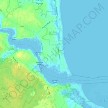
Name: Ferry Beach topographic map, elevation, terrain.
Location: Ferry Beach, York County, Maine, 04063, USA (43.45096 -70.40873 43.49096 -70.36873)
Average elevation: 20 ft
Minimum elevation: -23 ft
Maximum elevation: 69 ft