
Le Fouilly topographic map
Interactive map
Click on the map to display elevation.
About this map
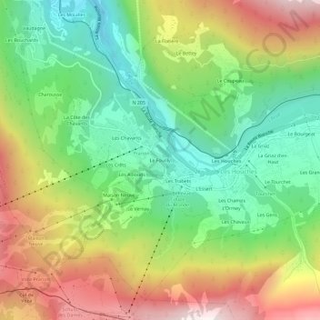
Name: Le Fouilly topographic map, elevation, terrain.
Average elevation: 4,242 ft
Minimum elevation: 2,753 ft
Maximum elevation: 6,348 ft
Other topographic maps
Click on a map to view its topography, its elevation and its terrain.
Les Champs
France > Auvergne-Rhône-Alpes > Upper Savoy > Les Houches
Les Champs, Les Houches, Bonneville, Upper Savoy, Auvergne-Rhône-Alpes, Metropolitan France, 74310, France
Average elevation: 4,429 ft