
Sensenruth topographic map
Interactive map
Click on the map to display elevation.
About this map
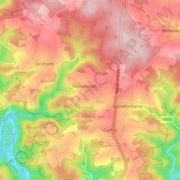
Name: Sensenruth topographic map, elevation, terrain.
Average elevation: 1,175 ft
Minimum elevation: 666 ft
Maximum elevation: 1,467 ft
Other topographic maps
Click on a map to view its topography, its elevation and its terrain.
Tombeau Du Géant
Belgium > Luxembourg > Neufchâteau > Bouillon > Ucimont > Botassart
Tombeau Du Géant, Moulin du Rivage, Botassart, Ucimont, Bouillon, Neufchâteau, Luxembourg, Wallonia, 6833, Belgium
Average elevation: 984 ft