
Thank you for supporting this site ❤️
Make a donation
Make a donation
Gear up for your next adventure:
As an Amazon Associate, this site earns from qualifying purchases at no extra cost to you.
Fräkmüntegg topographic map
Click on the map to display elevation.
Thank you for supporting this site ❤️
Make a donation
Make a donation
Gear up for your next adventure:
As an Amazon Associate, this site earns from qualifying purchases at no extra cost to you.
About this map
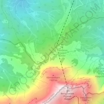
Name: Fräkmüntegg topographic map, elevation, terrain.
Location: Fräkmüntegg, Hergiswil (NW), Nidwalden, 6052, Switzerland (46.97922 8.23971 46.99922 8.25971)
Average elevation: 4,508 ft
Minimum elevation: 3,189 ft
Maximum elevation: 6,870 ft
Thank you for supporting this site ❤️
Make a donation
Make a donation
Gear up for your next adventure:
As an Amazon Associate, this site earns from qualifying purchases at no extra cost to you.