
La Feuillarde topographic map
Interactive map
Click on the map to display elevation.
About this map
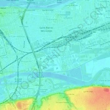
Name: La Feuillarde topographic map, elevation, terrain.
Average elevation: 180 ft
Minimum elevation: 141 ft
Maximum elevation: 338 ft
Other topographic maps
Click on a map to view its topography, its elevation and its terrain.
La Vicairerie
France > Centre-Val de Loire > Indre-et-Loire > Saint-Pierre-des-Corps
La Vicairerie, Saint-Pierre-des-Corps, Tours, Indre-et-Loire, Centre-Val de Loire, France métropolitaine, 37700, France
Average elevation: 174 ft
Les Muriers
France > Centre-Val de Loire > Indre-et-Loire > Saint-Pierre-des-Corps
Les Muriers, Saint-Pierre-des-Corps, Arrondissement de Tours, Indre-et-Loire, Centre-Val de Loire, France métropolitaine, 37700, France
Average elevation: 190 ft