
Shelton topographic map
Interactive map
Click on the map to display elevation.
About this map
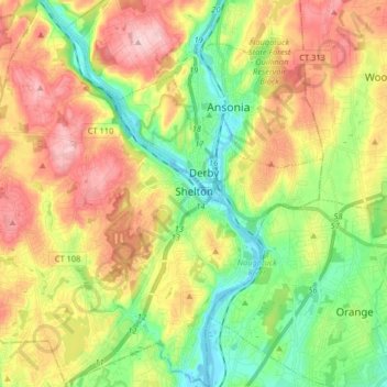
Name: Shelton topographic map, elevation, terrain.
Location: Shelton, Fairfield, Connecticut, United States (41.25460 -73.20480 41.37670 -73.06505)
Average elevation: 282 ft
Minimum elevation: -13 ft
Maximum elevation: 640 ft