
Thank you for supporting this site ❤️
Make a donation
Make a donation
Gear up for your next adventure:
As an Amazon Associate, this site earns from qualifying purchases at no extra cost to you.
El Jem topographic map
Click on the map to display elevation.
Thank you for supporting this site ❤️
Make a donation
Make a donation
Gear up for your next adventure:
As an Amazon Associate, this site earns from qualifying purchases at no extra cost to you.
About this map
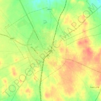
Name: El Jem topographic map, elevation, terrain.
Location: El Jem, الزاوية, معتمدية الجم, Mahdia, 5160, Tunisia (35.25664 10.67284 35.33664 10.75284)
Average elevation: 367 ft
Minimum elevation: 276 ft
Maximum elevation: 443 ft
Thank you for supporting this site ❤️
Make a donation
Make a donation
Gear up for your next adventure:
As an Amazon Associate, this site earns from qualifying purchases at no extra cost to you.