
Diep River topographic map
Interactive map
Click on the map to display elevation.
About this map
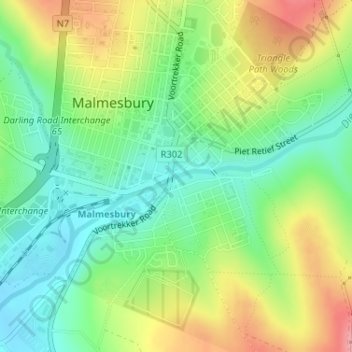
Name: Diep River topographic map, elevation, terrain.
Average elevation: 476 ft
Minimum elevation: 328 ft
Maximum elevation: 692 ft
Other topographic maps
Click on a map to view its topography, its elevation and its terrain.
Swartland Ward 3
RSA > Western Cape > Swartland Local Municipality
Swartland Ward 3, Swartland Local Municipality, West Coast District Municipality, Western Cape, 7310, RSA
Average elevation: 453 ft