
Thank you for supporting this site ❤️
Make a donation
Make a donation
Gear up for your next adventure:
As an Amazon Associate, this site earns from qualifying purchases at no extra cost to you.
Maralal topographic map
Click on the map to display elevation.
Thank you for supporting this site ❤️
Make a donation
Make a donation
Gear up for your next adventure:
As an Amazon Associate, this site earns from qualifying purchases at no extra cost to you.
About this map
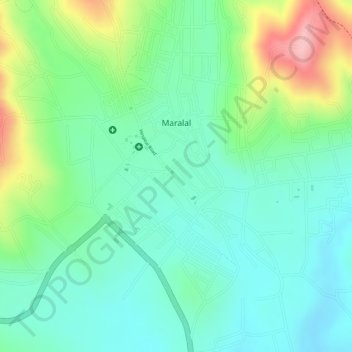
Name: Maralal topographic map, elevation, terrain.
Location: Maralal, Maralal ward, Samburu Central, Samburu, Kenya (1.08399 36.68706 1.10779 36.70876)
Average elevation: 6,417 ft
Minimum elevation: 6,224 ft
Maximum elevation: 6,831 ft
Thank you for supporting this site ❤️
Make a donation
Make a donation
Gear up for your next adventure:
As an Amazon Associate, this site earns from qualifying purchases at no extra cost to you.