
Çarşı Mahallesi topographic map
Interactive map
Click on the map to display elevation.
About this map
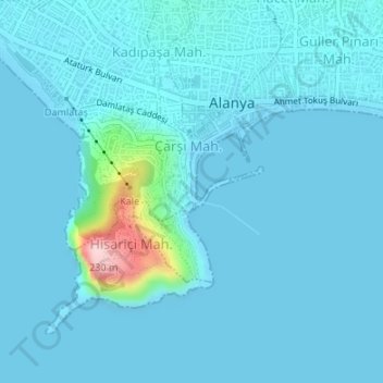
Name: Çarşı Mahallesi topographic map, elevation, terrain.
Location: Çarşı Mahallesi, Alanya, Antalya, Mediterranean Region, Turkey (36.53708 31.99820 36.53764 31.99847)
Average elevation: 62 ft
Minimum elevation: -23 ft
Maximum elevation: 787 ft
Other topographic maps
Click on a map to view its topography, its elevation and its terrain.
Tophane Mahallesi
Tophane Mahallesi, Alanya, Antalya, Mediterranean Region, Turkey
Average elevation: 56 ft