
樊村镇 topographic map
Interactive map
Click on the map to display elevation.
About this map
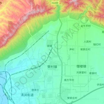
Name: 樊村镇 topographic map, elevation, terrain.
Location: 樊村镇, 河津市, 运城市, 山西省, 中国 (35.62785 110.65513 35.74383 110.75553)
Average elevation: 1,857 ft
Minimum elevation: 1,240 ft
Maximum elevation: 3,684 ft
Other topographic maps
Click on a map to view its topography, its elevation and its terrain.