
Fagajesto topographic map
Interactive map
Click on the map to display elevation.
About this map
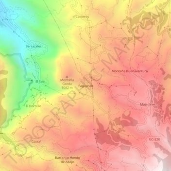
Name: Fagajesto topographic map, elevation, terrain.
Location: Fagajesto, Gáldar, Las Palmas, Canarie, 35468, Spagna (28.04061 -15.66677 28.08061 -15.62677)
Average elevation: 3,084 ft
Minimum elevation: 728 ft
Maximum elevation: 4,590 ft