
Grassy Pond topographic map
Interactive map
Click on the map to display elevation.
About this map
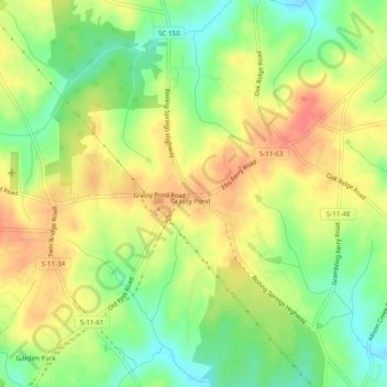
Name: Grassy Pond topographic map, elevation, terrain.
Location: Grassy Pond, Cherokee County, South Carolina, 29341, USA (35.11707 -81.69232 35.15707 -81.65232)
Average elevation: 810 ft
Minimum elevation: 712 ft
Maximum elevation: 902 ft