
Hochgolling topographic map
Interactive map
Click on the map to display elevation.
About this map
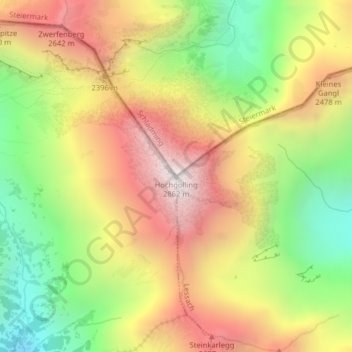
Name: Hochgolling topographic map, elevation, terrain.
Average elevation: 7,100 ft
Minimum elevation: 4,905 ft
Maximum elevation: 9,304 ft
Other topographic maps
Click on a map to view its topography, its elevation and its terrain.
Rohrmoos
Österreich > Steiermark > Schladming
Rohrmoos, Schladming, Gröbming, Liezen, Steiermark, 8970, Österreich
Average elevation: 3,028 ft