Volcan Tungurahua topographic map
Interactive map
Click on the map to display elevation.
About this map
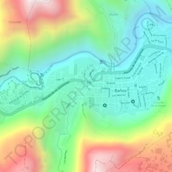
Name: Volcan Tungurahua topographic map, elevation, terrain.
Average elevation: 6,578 ft
Minimum elevation: 5,587 ft
Maximum elevation: 8,241 ft

Click on the map to display elevation.
Name: Volcan Tungurahua topographic map, elevation, terrain.
Average elevation: 6,578 ft
Minimum elevation: 5,587 ft
Maximum elevation: 8,241 ft