
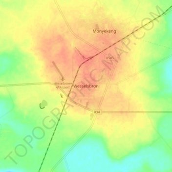
Wesselsbron topographic map
Interactive map
Click on the map to display elevation.
About this map
Name: Wesselsbron topographic map, elevation, terrain.
Average elevation: 4,255 ft
Minimum elevation: 4,173 ft
Maximum elevation: 4,321 ft
Other topographic maps
Click on a map to view its topography, its elevation and its terrain.
Bothaville
South Africa > Free State > Lejweleputswa District Municipality > Nala Local Municipality
Bothaville, Nala Local Municipality, Lejweleputswa District Municipality, Free State, 9660, South Africa
Average elevation: 4,222 ft
Vaal River
South Africa > Free State > Lejweleputswa District Municipality > Nala Local Municipality
Vaal River, Nala Ward 10, Nala Local Municipality, Lejweleputswa District Municipality, Free State, South Africa
Average elevation: 4,085 ft