
Thank you for supporting this site ❤️
Make a donation
Make a donation
Gear up for your next adventure:
As an Amazon Associate, this site earns from qualifying purchases at no extra cost to you.
Hamra topographic map
Click on the map to display elevation.
Thank you for supporting this site ❤️
Make a donation
Make a donation
Gear up for your next adventure:
As an Amazon Associate, this site earns from qualifying purchases at no extra cost to you.
About this map
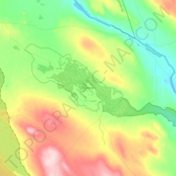
Name: Hamra topographic map, elevation, terrain.
Location: Hamra, Ljusdals kommun, Gävleborg County, Sweden (61.73231 14.72939 61.78063 14.93119)
Average elevation: 1,434 ft
Minimum elevation: 1,083 ft
Maximum elevation: 1,985 ft
Thank you for supporting this site ❤️
Make a donation
Make a donation
Gear up for your next adventure:
As an Amazon Associate, this site earns from qualifying purchases at no extra cost to you.