
Sudan topographic map
Interactive map
Click on the map to display elevation.
About this map
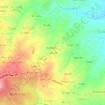
Name: Sudan topographic map, elevation, terrain.
Location: Sudan, Arua, Northern Region, 481, Uganda (3.00394 30.91759 3.04394 30.95759)
Average elevation: 3,812 ft
Minimum elevation: 3,589 ft
Maximum elevation: 4,072 ft