
Río Búrdalo topographic map
Interactive map
Click on the map to display elevation.
About this map
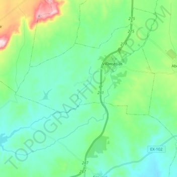
Name: Río Búrdalo topographic map, elevation, terrain.
Location: Río Búrdalo, Escurial, Cáceres, Extremadura, 10263, España (39.17825 -5.98952 39.27874 -5.83443)
Average elevation: 1,204 ft
Minimum elevation: 932 ft
Maximum elevation: 2,159 ft