
Thank you for supporting this site ❤️
Make a donation
Make a donation
Gear up for your next adventure:
As an Amazon Associate, this site earns from qualifying purchases at no extra cost to you.
A Merca topographic map
Click on the map to display elevation.
Thank you for supporting this site ❤️
Make a donation
Make a donation
Gear up for your next adventure:
As an Amazon Associate, this site earns from qualifying purchases at no extra cost to you.
About this map
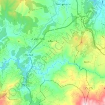
Name: A Merca topographic map, elevation, terrain.
Location: A Merca, Terra da Celanova, Ourense, Galicia, Spain (42.15318 -7.96365 42.26704 -7.84962)
Average elevation: 1,539 ft
Minimum elevation: 1,010 ft
Maximum elevation: 2,953 ft
Thank you for supporting this site ❤️
Make a donation
Make a donation
Gear up for your next adventure:
As an Amazon Associate, this site earns from qualifying purchases at no extra cost to you.