
Baldwin Heights topographic map
Interactive map
Click on the map to display elevation.
About this map
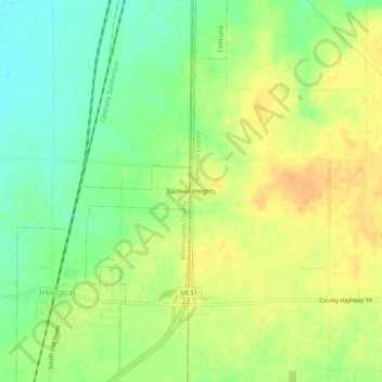
Name: Baldwin Heights topographic map, elevation, terrain.
Location: Baldwin Heights, Jefferson County, Illinois, 62848, USA (38.42977 -89.16479 38.46977 -89.12479)
Average elevation: 541 ft
Minimum elevation: 482 ft
Maximum elevation: 594 ft