
Chilete topographic map
Interactive map
Click on the map to display elevation.
About this map
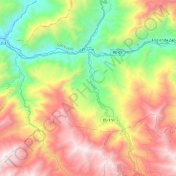
Name: Chilete topographic map, elevation, terrain.
Location: Chilete, Contumazá, Cajamarca, Peru (-7.29974 -78.90648 -7.21417 -78.74211)
Average elevation: 5,961 ft
Minimum elevation: 2,320 ft
Maximum elevation: 10,285 ft