
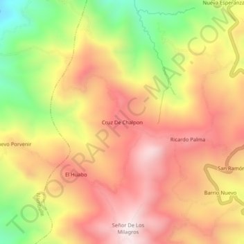
Cruz De Chalpon topographic map
Interactive map
Click on the map to display elevation.
About this map
Name: Cruz De Chalpon topographic map, elevation, terrain.
Average elevation: 4,882 ft
Minimum elevation: 3,297 ft
Maximum elevation: 6,043 ft
Other topographic maps
Click on a map to view its topography, its elevation and its terrain.
La Cordillera
Peru > Cajamarca > San Ignacio > La Cordillera
La Cordillera, San Ignacio, Province of San Ignacio, Cajamarca, Peru
Average elevation: 4,465 ft