
Chimegaon topographic map
Interactive map
Click on the map to display elevation.
About this map
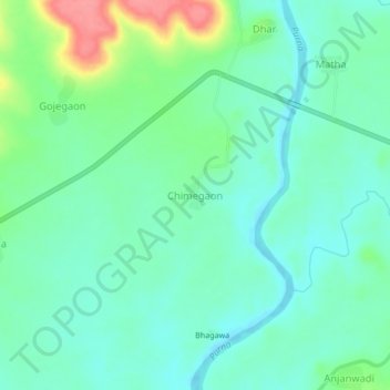
Name: Chimegaon topographic map, elevation, terrain.
Location: Chimegaon, Aundha (Nagnath), Hingoli, Maharashtra, India (19.51229 76.93790 19.55229 76.97790)
Average elevation: 1,325 ft
Minimum elevation: 1,250 ft
Maximum elevation: 1,529 ft
Other topographic maps
Click on a map to view its topography, its elevation and its terrain.
Aundha (Nagnath)
India > Maharashtra > Aundha (Nagnath)
Aundha (Nagnath), Hingoli, Maharashtra, 431705, India
Average elevation: 1,460 ft