
Knole Park (Deer Park) topographic map
Interactive map
Click on the map to display elevation.
About this map
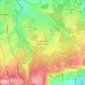
Name: Knole Park (Deer Park) topographic map, elevation, terrain.
Average elevation: 528 ft
Minimum elevation: 315 ft
Maximum elevation: 715 ft