
Henderson Island topographic map
Interactive map
Click on the map to display elevation.
About this map
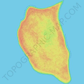
Name: Henderson Island topographic map, elevation, terrain.
Location: Henderson Island, Pitcairn Islands (-24.42303 -128.35700 -24.33048 -128.29162)
Average elevation: 39 ft
Minimum elevation: 0 ft
Maximum elevation: 128 ft
Other topographic maps
Click on a map to view its topography, its elevation and its terrain.