
Aire Libre topographic map
Interactive map
Click on the map to display elevation.
About this map
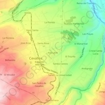
Name: Aire Libre topographic map, elevation, terrain.
Location: Aire Libre, Cevallos, Tungurahua, 180403, Ecuador (-1.37283 -78.62992 -1.33283 -78.58992)
Average elevation: 9,419 ft
Minimum elevation: 8,704 ft
Maximum elevation: 10,125 ft