
黄桥镇 topographic map
Interactive map
Click on the map to display elevation.
About this map
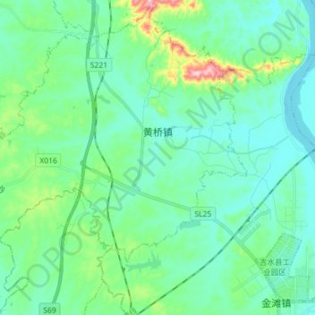
Name: 黄桥镇 topographic map, elevation, terrain.
Location: 黄桥镇, 吉水县, 吉安市, 江西省, 中国 (27.24406 114.94358 27.36916 115.08534)
Average elevation: 276 ft
Minimum elevation: 108 ft
Maximum elevation: 974 ft
Other topographic maps
Click on a map to view its topography, its elevation and its terrain.