
Pulau Kai Besar topographic map
Interactive map
Click on the map to display elevation.
About this map
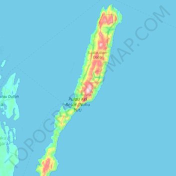
Name: Pulau Kai Besar topographic map, elevation, terrain.
Location: Pulau Kai Besar, Moluccas, Indonesia (-5.89923 132.74618 -5.25923 133.38618)
Average elevation: 85 ft
Minimum elevation: -3 ft
Maximum elevation: 2,493 ft
Other topographic maps
Click on a map to view its topography, its elevation and its terrain.