
River Delta topographic map
Interactive map
Click on the map to display elevation.
About this map
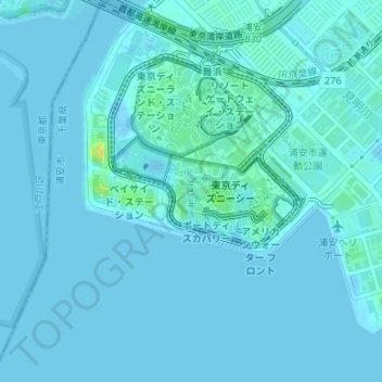
Name: River Delta topographic map, elevation, terrain.
Location: River Delta, 舞浜, Urayasu, Chiba Prefecture, 279-0031, Japan (35.62603 139.88176 35.62742 139.88177)
Average elevation: 7 ft
Minimum elevation: -16 ft
Maximum elevation: 75 ft
Other topographic maps
Click on a map to view its topography, its elevation and its terrain.