
Ciudad Lerdo topographic map
Interactive map
Click on the map to display elevation.
About this map
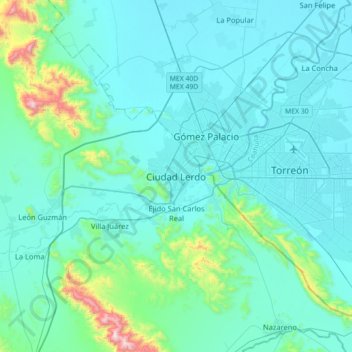
Name: Ciudad Lerdo topographic map, elevation, terrain.
Location: Ciudad Lerdo, Lerdo, Durango, 35150, México (25.37664 -103.68525 25.69664 -103.36525)
Average elevation: 4,026 ft
Minimum elevation: 3,635 ft
Maximum elevation: 7,057 ft