
Saragozza-Porto topographic map
Interactive map
Click on the map to display elevation.
About this map
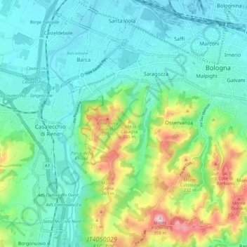
Name: Saragozza-Porto topographic map, elevation, terrain.
Location: Saragozza-Porto, Bologna, BO, EMR, Italia (44.44270 11.28152 44.51292 11.34575)
Average elevation: 381 ft
Minimum elevation: 118 ft
Maximum elevation: 1,148 ft
Other topographic maps
Click on a map to view its topography, its elevation and its terrain.