Geolocate

Tintern topographic map

Click on the map to display elevation.

About this map

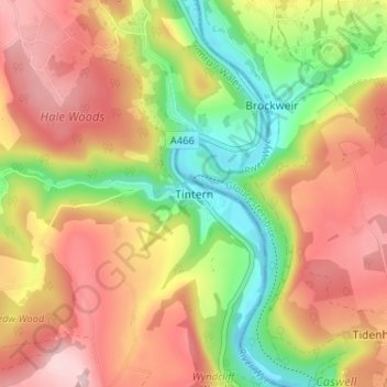
Name: Tintern topographic map, elevation, terrain.

Location: Tintern, Monmouthshire, Wales, NP16 6SY, United Kingdom (51.67801 -2.70088 51.71801 -2.66088)

Average elevation: 456 ft

Minimum elevation: -3 ft

Maximum elevation: 869 ft

Gear up for your next adventure:

🥘Titanium Cookware - Durable, featherlight pots and pans for backpacking
🧥Waterproof Jacket for Hiking - Breathable and rugged rain jacket for outdoor excursions
🕶️Glacier Sunglasses - Side shields to protect eyes from high-altitude snow glare
🔌Solar Panel Charger - Charge gear sustainably outdoors
Camping Coffee Makers - Enjoy premium coffee at the summit or campsite

As an Amazon Associate, this site earns from qualifying purchases at no extra cost to you.