
Alumy Creek topographic map
Interactive map
Click on the map to display elevation.
About this map
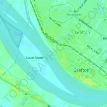
Name: Alumy Creek topographic map, elevation, terrain.
Location: Alumy Creek, Grafton, Clarence Valley Council, Australia (-29.68751 152.92367 -29.68671 152.92586)
Average elevation: 16 ft
Minimum elevation: -3 ft
Maximum elevation: 36 ft
Other topographic maps
Click on a map to view its topography, its elevation and its terrain.
Lawrence Road
Australia > Grafton > Lawrence Road
Lawrence Road, Grafton, Clarence Valley Council, Australia
Average elevation: 236 ft
Mangrove Creek
Australia > New South Wales > Grafton
Mangrove Creek, Grafton, Clarence Valley Council, Australia
Average elevation: 108 ft