
Thank you for supporting this site ❤️
Make a donation
Make a donation
Gear up for your next adventure:
As an Amazon Associate, this site earns from qualifying purchases at no extra cost to you.
Tintigny topographic map
Click on the map to display elevation.
Thank you for supporting this site ❤️
Make a donation
Make a donation
Gear up for your next adventure:
As an Amazon Associate, this site earns from qualifying purchases at no extra cost to you.
About this map
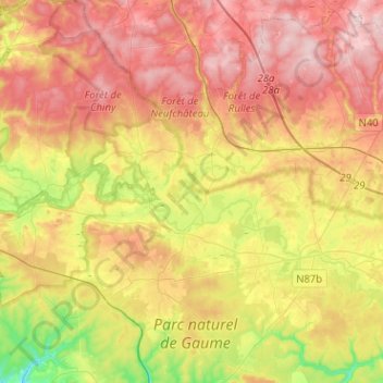
Name: Tintigny topographic map, elevation, terrain.
Location: Tintigny, Virton, Luxembourg, Wallonia, Belgium (49.61936 5.41654 49.78336 5.55666)
Average elevation: 1,201 ft
Minimum elevation: 764 ft
Maximum elevation: 1,572 ft
Thank you for supporting this site ❤️
Make a donation
Make a donation
Gear up for your next adventure:
As an Amazon Associate, this site earns from qualifying purchases at no extra cost to you.