
D'Hoppe topographic map
Interactive map
Click on the map to display elevation.
About this map
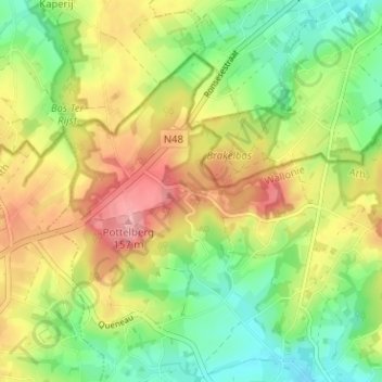
Name: D'Hoppe topographic map, elevation, terrain.
Location: D'Hoppe, Vloesberg, Henegouwen, Wallonië, 7880, België (50.74743 3.68971 50.78743 3.72971)
Average elevation: 305 ft
Minimum elevation: 125 ft
Maximum elevation: 528 ft