Geolocate

Burke topographic map

Click on the map to display elevation.

About this map
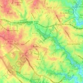
Name: Burke topographic map, elevation, terrain.

Location: Burke, Fairfax County, Virginia, United States (38.74520 -77.30127 38.81728 -77.22685)

Average elevation: 315 ft

Minimum elevation: 171 ft

Maximum elevation: 446 ft

Fairfax County trails, hiking, mountain biking, running and outdoor activities

Gear up for your next adventure:

🧯Emergency Survival Kit - All‑in‑one survival essentials for the backcountry
📚Navigation Handbooks - Master the art of reading topographic maps and using a compass
🛌Ultralight Sleeping Bags - Compact down bags for cold nights in the wilderness
🔭Stargazing Telescopes - Perfect for camping in low-light pollution areas shown on maps
🧤Tactile Hiking Gloves - Keep hands warm while operating GPS and smartphone screens

As an Amazon Associate, this site earns from qualifying purchases at no extra cost to you.