
French Cay topographic map
Interactive map
Click on the map to display elevation.
About this map
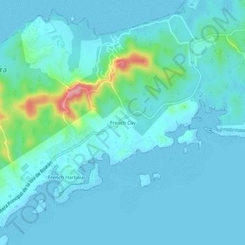
Name: French Cay topographic map, elevation, terrain.
Location: French Cay, Roatan, Bay Islands, Honduras (16.34082 -86.46843 16.38082 -86.42843)
Average elevation: 52 ft
Minimum elevation: -3 ft
Maximum elevation: 397 ft