
Huaral topographic map
Interactive map
Click on the map to display elevation.
About this map
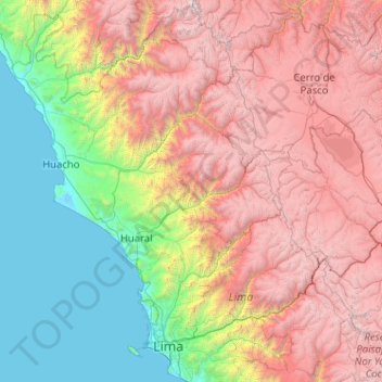
Name: Huaral topographic map, elevation, terrain.
Location: Huaral, Ihuarí, Huaral, Lima, Pérou (-11.27000 -76.93667 -11.23000 -76.89667)
Average elevation: 7,726 ft
Minimum elevation: 5,390 ft
Maximum elevation: 10,331 ft